
Project Overview
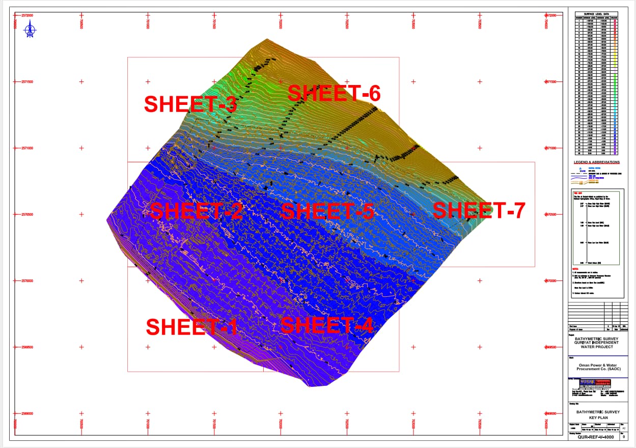
The bathymetric survey at the proposed survey area for pipeline launching in Quriyat IWP Power Plant was conducted by Nusail Engineering Consultancy, Sultanate of Oman. The survey was carried out to monitor and calculate the dredging quantity. Nusail Engineering Consultancy was awarded the contract for the Bathymetric Survey for the "Independent Water Project" in Al Ghubrah, Muscat, by Oman Power and Water Procurement Co. (SAOC).
Scope of the Survey
The scope of the survey included both bathymetric and seabed surveys. It aimed to provide a qualitative interpretation of the relevance from an environmental point of view, create a map of the situation of any existing protected species, and provide an overview of their density (low, medium, and high density). Accurate numbers of density were not necessary.
Equipments of the Study
- Odum Hydrotrac Echo Sounder
- Transducer
- Valeport Tide Gauge
- Sokkia RTK GPS
- Sokkia Total Station and Bar Plate
- Valeport Midas CTD+
- VideoRay Pro III XE GTO ROV System
- Water Sampler/Sediment Sampler
- VideoRay Pro III XE GTO ROV System
- VideoRay ProIII Integrated Control Unit
- VideoRay ProIII Spares Kit
- VideoRay ProIII XE GTO R.O.V.
- VideoRay Tether Cable, Neutral 75m
- VideoRay Tether Cable, Positive 40m
- Ocean Tools VO-5 Video Overlay (3 Ch)
- 14" Composite Video Monitor
- Pioneer DVD Recorder
Bathymetry Survey Procedure
Nusail installed an automatic water level recorder during the bathymetric survey. The MKIII dual frequency echo sounder was utilized, with 210 & 33 kHz digital output logging by the navigation computer. CTDS dips and bar checks were conducted, with values entered directly into the echo sounder processor at the beginning of each day. Phase and speed settings ensured the best possible record unobstructed by the end of line information. The HydroPro software converted the antenna position into local UTM projection coordinates. Positions were entered into the navigation system and displayed on the helmsman’s display. During the survey operations, peripherals were also logged into the software.
Seabed Survey Procedure
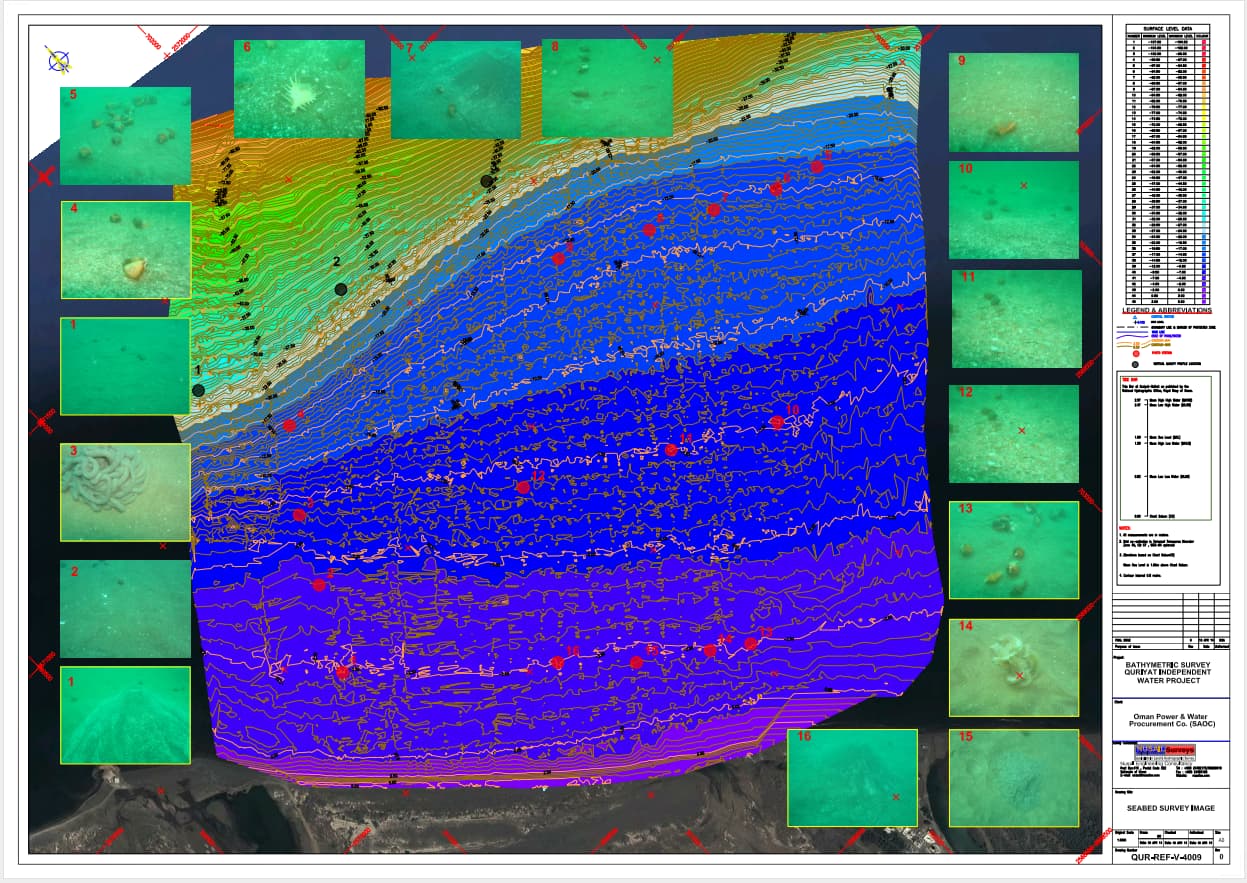
Using underwater photography and video as recording methods, underwater observations of the epifauna on the seafloor were completed. The ROV Video was also used for the visual survey. The underwater video camera was suspended approximately 300-600mm above the seafloor and at an angle of approximately 30º below the horizontal. Characteristics of the seafloor were surveyed along linear transects conducted approximately perpendicular to the shoreline within defined locations. The course of each transect was plotted using a Global Positioning System (GPS). Images were captured, with locations being noted at initial points, when habitats or particular features were observed, and at one-minute intervals. Digital transect records were included by the contractor as DVDs attached to the report.
Report
The report included an inventory of the dominant existing species (flora and fauna) with a focus on identified protected species in the study area, a qualitative interpretation of their relevance from an environmental point of view, a map of the situation of any existing protected species, and an overview of their density (low, medium, and high density). Photographs and videos of the seafloor epifauna, as well as their locations, were also included.
Result
An Odomhydrotack single frequency (200 kHz) Single beam Echo Sounder was utilized to acquire bathymetry data. As a result of the 'bar check' results, a velocity of 1540 m/s was used as the velocity of sound in water during data acquisition. The bathymetry data were processed using HydroPro Software. The project was successfully completed on the time schedule, and the report and drawing were submitted.
Marine benthic invertebrates generally comprise polychaetes, molluscs (bivalves, gastropods, and scaphopods), echinoderms, and crustaceans. Molluscan shells occur in all marine habitats present in the Gulf of Oman coastal region, composed mainly of submerged soft sand and gravel plains with a few habitats of macroalgae (seaweeds), seagrass, and coral reefs. A shallow benthic epifaunal survey was conducted at various points (locations) in varying depths between 3 – 40 m, spread along four (4) transects T1 – T4 running perpendicular to the shoreline to collect background seabed information to assess the suitability of proposing the locations for installing the inlet and effluent discharge pipes of the desalination plant. During the survey, the substrata observed were composed mainly of submerged loose soft sandy and gravely plains with sporadic occurrences of seaweeds and no presence of seagrass or corals observed.
