
Project Overview
Nusail Engineering Consultancy was contracted by Atkins to provide Hydrographic Survey, Geophysical (Sub-Bottom Profiling) Survey, and Ocean Current Investigation Survey services for the Khasab Port area Redevelopment site Investigation study in Khasab, Sultanate of Oman.
Scope of the Survey
- Bathymetric Survey and Side Scan Sonar Survey
- Geophysical (Seismic) Survey
- Ocean Current Measurement Survey
Equipment List
The following data collection systems were used:
| System | Purpose |
|---|---|
| Sokkia RTK GPS Receiver-BASE | Survey Navigation Positioning and Benchmark Positioning |
| Sokkia RTK GPS Receiver-Rover | Survey Navigation Positioning and Benchmark Positioning |
| ADL Vantage Pro - Pacific Crest Hemisphere DGPS | Wireless Digital Data Link |
| Survey Depth Collection Sonar | Collects Tidal Data for Correcting Depths in Post Processing |
| Current Profiler | RDI Teledyne ADCP Current Meter |
| Odum Hydrotrac Echosounder | Depth Measurement |
| Valeport Tide Gauge | Tide Measurement |
| Edge Tech 4125-P | Side Scan Survey Acquisition |
| GeoPulse GeoAcoustics Pinger | Seismic Survey Data Acquisition |
Survey Procedure
A pre-survey investigation was conducted to ensure a safe working area and confirm that the client’s survey objectives could be met within the pre-defined survey areas. During the survey, a Valeport Tide Gauge was installed for tide correction. All data from each of the peripherals were logged into software.
The bathymetric survey aimed to determine the sea bed profile along the proposed Khasab port area redevelopment site and the optional area of the Khor Qada on the seaward boundary of the plot. The results of the survey were used to understand the seabed profile along both areas. Nusail Engineering Consultancy installed an automatic water level recorder during the bathymetric survey to monitor the state of the sea. The depth data collected during the survey was adjusted to the local vertical level using the water level variations recorded by the installed recorder.
Results
Bathymetry Survey
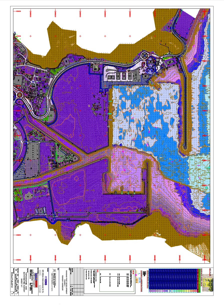
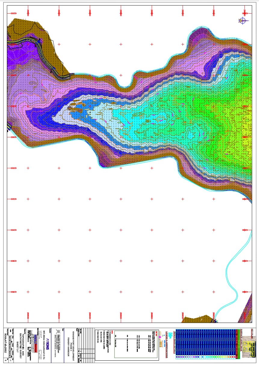
An Odom Hydrotrac single frequency (200 kHz) single beam Echo Sounder was used to acquire bathymetry data. The 'bar check' results indicated a velocity of 1520 m/s for sound in water during data acquisition. The data were processed using HydroPro Software. The survey, conducted from April 19th to May 19th, resulted in a bathymetry chart at a 1:1000 scale. The survey area displayed irregular seabed features with relatively shallow conditions, particularly near the shore, in front of the creek, and inside the breakwater.
Current Measurements
- Stn L1: The current speed at the surface was generally higher than at the bottom. Current directions were mainly between 10° and 90° from mid-depth to the bottom, with scattered directions at the surface up to 4 m depth.
- Stn L2: The current speed at the surface was generally higher than at the bottom. Current directions were scattered in all directions.
- Stn L3: The current speed at the surface was generally higher than at the bottom. Current directions were mainly between 170° and 270° up to 12 m, with scattered directions at the bottom.
- Stn L4: The current speed at the surface was generally higher than at the bottom. Current directions were mainly between 170° and 220° at the surface up to 3 m, with scattered directions at the bottom.
Geophysical Survey Findings
The seabed investigations, conducted through side scan sonar and shallow seismic surveys, concluded that the seabed is predominantly composed of sedimentary rocks. Finer sediment patches were scattered across the seafloor. Man-made objects and sunken boats were observed at various locations. The sub-seabed comprised compact sediment or sedimentary rock. The reduced penetration of acoustic waves due to the higher acoustic impedance of the sub-seabed indicated consolidated sedimentary formations. However, no hard rocky (basement rock) formations were detected within the penetration limit. Boreholes at discrete locations will be necessary to confirm the nature, type, and thickness of different geological formations below the seabed.
