UK PROJECTS
Khasab Port Survey
Atkins Khasab, Oman Multibeam Bathymetric Survey, Side Scan Sonar Survey, Sub-bottom Profile Survey, Water Quality Analysis, Sediment Quality Analysis, and Wave & Current Analysis
Lidar Drone Surveying - Orthomosaic Mapping and Point Cloud Survey
OIF
Oman
Barr Al Hikman Royal Aqua Project - 80,000
hectares
Multibeam Bathymetric Survey, Derived Bathymetric Survey & Sea Water Quality Survey
AYESA-SWCC
Al Khobar, Saudi Arabia
Al Khobar Desalination Plant
3D Scanning Survey
3D BIMdesign
UK
Princes Risborough
3D Scanner and Lidar Drone Surveying - Orthomosaic Mapping and Point Cloud Survey and DEM
Oman Power & Water Procurement Co. (OPWP)
Oman
Ibri Solar Project - 1300 Hectares
3D Lidar Survey, Multibeam Bathymetric Survey, Utility and Underwater Inspection
WSP / Omran
Oman
Development of Port Sultan Qaboos, Muscat
3D Scanning Survey
DAR (Oman Aviation Group)
Oman
Old Airport Terminal Muscat
Multibeam Bathymetric Survey
Majid Al Futtaim (Al Mouj)
Oman
Al Mouj
3D Scanning Survey
PORTLAND
Oxfordshire, UK
7 The Green North/ Coachman's Cottage = Stables And Grounds - Warborough-Oxfordshire
3D Scanner and Lidar Drone Surveying - Orthomosaic Mapping and Point Cloud Survey and DEM
Wood Plc / Duqm Refinery
Oman
236 km Gas Pipeline and Plant Plots - 2,000 Hectares
Lidar Drone Surveying - Orthomosaic Mapping and Point Cloud Survey
VINCI Construction Grands Project
Oman
Ad Dimaniyat Islands
Multibeam Bathymetric Survey, Side Scan Sonar Survey, Sub-bottom Profile Survey, Water quality analysis, Sediment quality analysis and Wave & current analysis
OPWP
Oman
Khasab Port Survey
Bathymetric Survey
OADC
Oman
Al Qurun & AL Khuwemah
Multbeam Bathymetric Survey, Side Scan Sonar Survey, Sub-bottom Profile Survey, Water quality analysis, Sediment quality analysis and Wave & current analysis
OPWP / Fichtner
Oman
Duqm
Multibeam Bathymetric Survey
VEOLIA L.L.C.
Oman
Sea Water Intake - Sohar Port
Bathymetric Survey
MARINE TECHNOLOGY
Oman
Bar Al Jissah and Masirah (Post Study)
Topographic & Property Survey
KEO (HAYA Water)
Oman
Seeb Network 150 km & more than 4000 Property Connect Survey
Multibeam Bathymetric Survey & Sea Water Quality Survey
AYESA- SWCC
Saudi Arabia
Shoiba 5, Desalination Plant
Lidar Drone Surveying - Orthomosaic Mapping and Point Cloud Survey
Petroleum Development Oman (PDO)
Oman
Rima Water Treatment Plant - 2500 Hectares
Multibeam Bathymetric Survey & Sea Water Quality Survey
AYESA- SWCC
Saudi Arabia
Shuqaiq, Desalination Plan
Lidar Drone Surveying - Orthomosaic Mapping, Point Cloud Survey & DEM
Green Hydrogen & Chemicals PSG9
Oman
Oman Hydrogen Plant at Duqm - 10,200 Hectares
Multibeam Bathymetric Survey
AYESA-SWCC
Saudi Arabia
Rabigh 4, Desalination Plant
Multibeam Bathymetric Survey
ASYAD
Oman
Port Suwaiq
Multbeam Bathymetric Survey, Side Scan Sonar Survey, Sub-bottom Profile Survey, Water Quality Analysis, Sediment Quality Analysis and Wave & Current Analysis
Parsons
Oman
Duqm Port
Multibeam Bathymetric Survey and Wave & Current Analysis
Worley Parsons
Oman
Marine Rescue Area
Multbeam Bathymetric Survey, Side Scan Sonar Survey, Sub-bottom Profile Survey, Water Quality Analysis, Sediment Quality Analysis and Wave & Current Analysis
DATiS Developments
Shinas, Oman
Shinas Port
Bathymetric Survey
Flown Modern Enterprises
Masirah Island, Oman
Masirah Sea Water Intake
Multibeam Bathymetric Survey & Sea Water Quality Survey
AYESA-SWCC
Saudi Arabia
Ummlujj, Al Wajh, Duba & Al Haql. 4 No. of Desalination Plants
Pipeline Settingout Survey
Fugro / Petrofac
Oman
OS-1547-14 Petrofac - RHIP
Topographic Survey
Technip
Oman
Duqm Refinery Project at Duqm
Multibeam Bathymetric Survey & Sea Water Quality Survey
AYESA- SWCC
Saudi Arabia
Shoiba 5, Desalination Plant
Lidar Drone Surveying - Orthomosaic Mapping and Point Cloud Survey
Petroleum Development Oman (PDO)
Oman
Rima Water Treatment Plant - 2500 Hectares
Multibeam Bathymetric Survey & Sea Water Quality Survey
AYESA- SWCC
Saudi Arabia
Shuqaiq, Desalination Plant
Lidar Drone Surveying - Orthomosaic Mapping, Point Cloud Survey & DEM
Green Hydrogen & Chemicals PSG9
Oman
Oman Hydrogen Plant at Duqm - 10,200 Hectares
Multibeam Bathymetric Survey
AYESA-SWCC
Saudi Arabia
Rabigh 4, Desalination Plant
Multibeam Bathymetric Survey
ASYAD
Oman
Port Suwaiq
Multbeam Bathymetric Survey, Side Scan Sonar Survey, Sub-bottom Profile Survey, Water Quality Analysis, Sediment Quality Analysis and Wave & Current Analysis
Parsons
Oman
Duqm Port
Multibeam Bathymetric Survey & Sea Water Quality Survey
AYESA- SWCC
Saudi Arabia
Shoiba 5, Desalination Plant
Lidar Drone Surveying - Orthomosaic Mapping and Point Cloud Survey
Petroleum Development Oman (PDO)
Oman
Rima Water Treatment Plant - 2500 Hectares
Multibeam Bathymetric Survey & Sea Water Quality Survey
AYESA- SWCC
Saudi Arabia
Shuqaiq, Desalination Plant
Lidar Drone Surveying - Orthomosaic Mapping, Point Cloud Survey & DEM
Green Hydrogen & Chemicals PSG9
Oman
Oman Hydrogen Plant at Duqm - 10,200 Hectares
Multibeam Bathymetric Survey
AYESA-SWCC
Saudi Arabia
Rabigh 4, Desalination Plant
Multibeam Bathymetric Survey
ASYAD
Oman
Port Suwaiq
Multbeam Bathymetric Survey, Side Scan Sonar Survey, Sub-bottom Profile Survey, Water Quality Analysis, Sediment Quality Analysis and Wave & Current Analysis
Parsons
Oman
Duqm Port
Multibeam Bathymetric Survey and Wave & Current Analysis
Worley Parsons
Oman
Marine Rescue Area
OUR SERVICES
Precision Surveying: Reliable, Expert Services
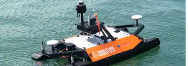
Hydrographic and Oceanographic Surveys
NUSAIL Engineering Consultancy specializes in accurate underwater data through hydrographic and oceanographic surveys. Our expertise supports sustainable development and management.
Learn more
Mobile Mapping Applications
NUSAIL Engineering Consultancy is a leader among mobile mapping companies, utilizing advanced mobile mapping systems to deliver precise geospatial data. Our mobile mapping applications streamline the collection of detailed terrain and infrastructure information, enhancing accuracy and efficiency for a variety of projects.
Learn more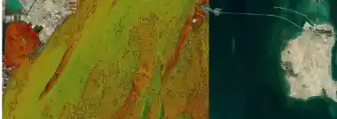
GIS and Remote Sensing
NUSAIL leverages GIS and Remote Sensing for strategic planning and resource management, transforming geospatial data into actionable insights.
Learn more
3D Laser Scanning Surveys
NUSAIL Surveys employs cutting-edge 3D laser scanning for precise mapping and infrastructure surveys, ensuring accurate results.
Learn more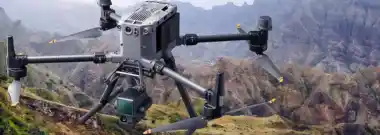
Drone Aerial Surveying and Geo-Mapping
Nusail utilizes drone technology for high-resolution terrain mapping and accurate data collection, enhancing project precision.
Learn more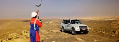
Land Surveying / Topographic Survey
NUSAIL specializes in Land and Topographic Surveys, offering precise Earth's surface measurements for project development.
Learn more
Utility Survey
NUSAIL offers Utility Surveys for accurate underground utility mapping, ensuring safe and efficient project management.
Learn more

