Utility Survey Oman
Utility Survey And Underground Mapping Services in Oman
Locate and map underground utilities with confidence using Nusail’s advanced utility surveying solutions. Our GPR and EML surveys provide accurate subsurface data for construction, engineering, and asset management projects. Detailed 2D and 3D deliverables help reduce risks, improve planning, and prevent costly utility strikes.
Utility Survey And Underground Mapping Services
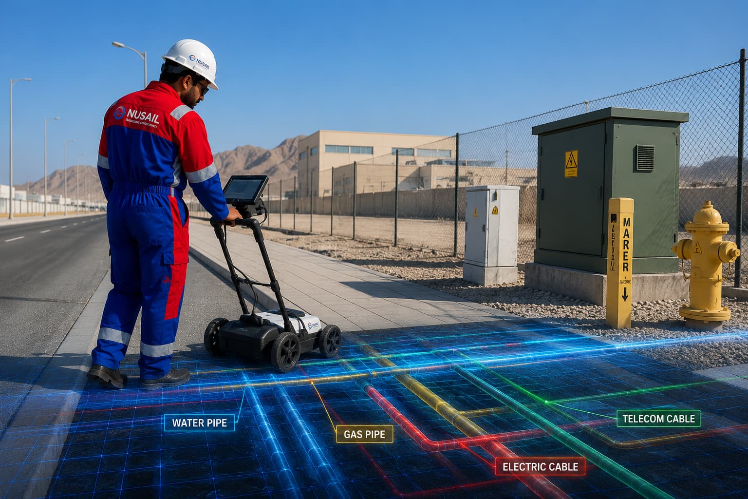
Nusail Engineering Consultancy provides comprehensive Utility Survey and Underground Mapping Services designed to accurately identify, locate, and map buried utilities and subsurface infrastructure before construction, excavation, or development activities begin.Using advanced technologies such as Ground Penetrating Radar (GPR), Electromagnetic Location (EML), GPS, GIS mapping, and digital data processing, we deliver reliable information on underground assets including water pipelines, sewer networks, electrical cables, telecommunications lines, gas pipelines, drainage systems, ducts, culverts, and other buried infrastructure.
Our experienced surveyors combine multiple detection methods to provide the highest possible level of accuracy, even in complex urban and industrial environments.Our underground mapping services include utility detection and tracing, GPR surveys, electromagnetic utility locating, drainage system mapping, asphalt thickness investigations, concrete scanning, void detection, underground asset verification, and comprehensive digital reporting.
Every survey is tailored to the specific requirements of the project, ensuring accurate and actionable results that support design, construction, maintenance, and asset management activities. With extensive experience across Oman and the wider Middle East, Nusail is a trusted partner for delivering accurate underground utility information that enhances project safety, reduces operational risks, and supports successful infrastructure development.

Utility survey work types
Nusail delivers underground utility detection, mapping and reporting for infrastructure, construction and asset management projects across Oman.
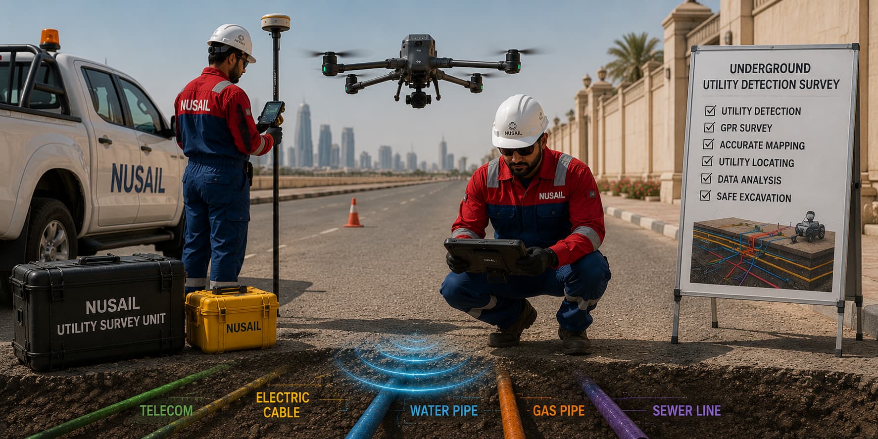
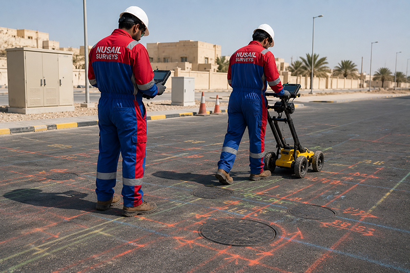
Underground Utility Detection Survey
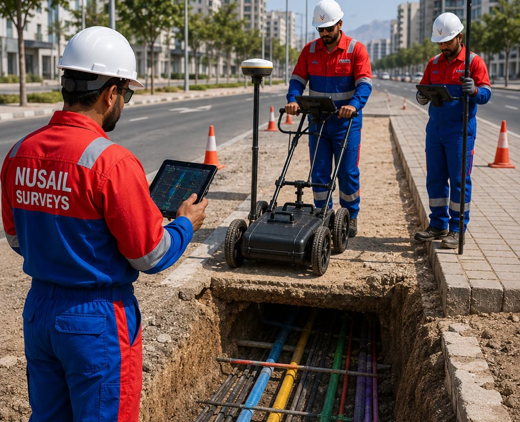
Ground Penetrating Radar (GPR) Survey
Electromagnetic Utility Detection

Underground Service Mapping

Drainage and Duct Route Tracing
Desktop Utility Record Search
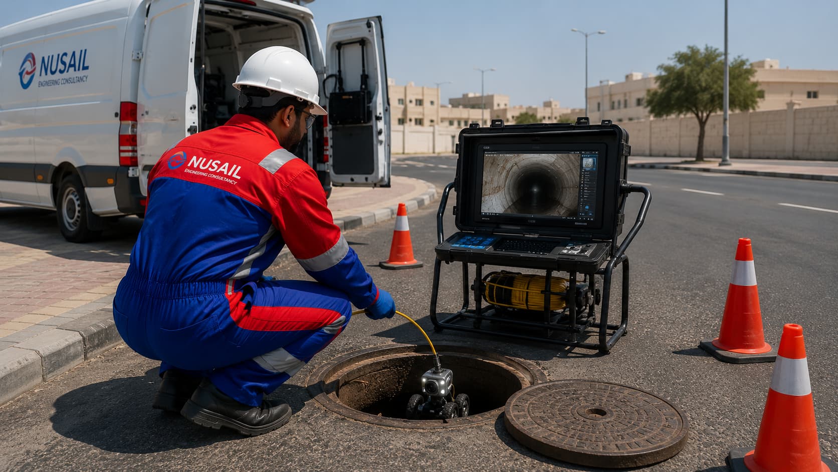
CCTV Drainage Survey
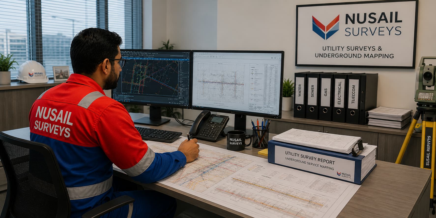
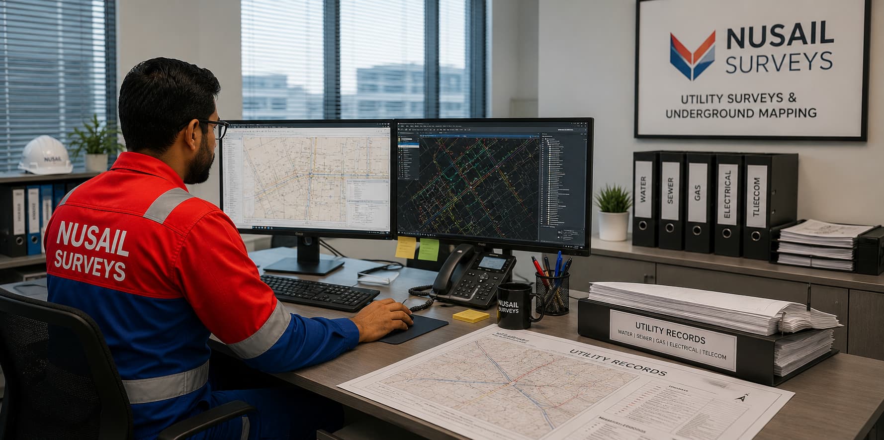
Utility Survey Drawings and Reports
Utility Survey And Underground Mapping Services
Underground Utility Mapping
Our Underground Utility Mapping services provide accurate detection and mapping of subsurface utilities and features, including:
- Cables
- Pipes
- Gas and sewer lines
- Drains
- Cavities
We utilize advanced technology and experienced surveyors to provide reliable and comprehensive results for infrastructure and construction projects.
GPR (Ground Penetrating Radar) Survey
We offer GPR survey services for the identification and mapping of subsurface features, including utilities, concrete thickness, rebar, concrete structural analysis, and voids. Our experienced GPR operators and specialized equipment provide accurate and reliable results for our clients.
Electromagnetic Location (EML) Survey
We also use EML surveying methods to map sub-surface utilities. Our team uses the latest radio detection equipment to provide the most advanced and reliable picture of underground services possible.
Drainage System Mapping
In addition to utility mapping, we offer drainage system mapping to identify and map underground drainage systems. This service provides valuable information for infrastructure and construction projects, helping to prevent damage to underground systems.
Asphalt Thickness Mapping
Our specialized equipment allows us to accurately determine the layers of asphalt and establish bedrock depth, providing valuable information for construction and maintenance projects.
Digital Mapping and Reporting
Our surveys accurately locate and map their findings to a digital format for 2D or 3D drawing. The output provides the client with a comprehensive digital representation of the underground utilities in the specified area. We can tailor these results to requirements such as:
Determined Boundary Plans
Preparation of legally binding plans that define property boundaries based on available evidence, expert opinion, and adherence to relevant regulations, helping to prevent or resolve disputes.
- PAS128 compliant
- BIM level 1 or 2 compliant
- Gas and sewer lines
- 2D/3D cylindrical models
- CAD layer management standards (client/sector specific)
Contact us to learn more about our Underground Utility Mapping services.
For more information on the diverse services we provide or to inquire about our laser scanning expertise, please reach out to us at:
Key Benefits:
- Accurate Data Collection: Our surveys provide precise information about the location and condition of underground utilities, minimizing the risk of accidental damage during construction.
- Improved Safety:By identifying and mapping underground utilities, we help ensure the safety of workers and the public during excavation and construction activities.
- Cost Savings:Accurate utility mapping reduces the likelihood of costly errors, such as hitting underground utilities, which can lead to delays and expensive repairs.
- Efficient Project Planning:Detailed underground maps allow for better project planning and coordination, reducing the chances of unexpected issues arising during construction.
- Regulatory Compliance:Our services ensure that all underground utilities are accounted for, helping clients meet regulatory requirements and avoid legal complications.

Portfolio / Selected case studies
Selected project experience demonstrating Nusail’s capability in land, marine, drone and geospatial survey projects. Full project references can be provided upon request.
Explore drone survey projects Oman and related topographic highlights using the filters below.
Contact / request quotation
Share site area, accuracy requirement, airspace constraints and deadline for a scoped proposal.
Oman office
Building No. 9459A, Way No. 897, Mawaleh North, P.O. Box 143, Postal Code 311, Sultanate of Oman