Bathymetric survey Oman
Bathymetric survey and seabed mapping in Oman
Depth measurement and seabed models for port maintenance, dredging, marine construction and navigation studies. Nusail supports bathymetric survey Oman projects with methods and reporting aligned to your engineering brief and local regulations.
Bathymetric Survey
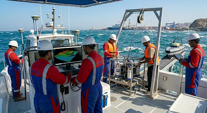
Bathymetric surveys provide accurate measurements of seabed and waterbody depths for ports, harbours, marinas, reservoirs, rivers, canals and coastal infrastructure projects. Using advanced echo sounding systems integrated with GNSS positioning, Nusail delivers detailed seabed models and depth information to support navigation safety, dredging operations, marine construction and environmental studies throughout Oman, Saudi Arabia and the UK.
Our bathymetric survey teams utilize single beam and multibeam sonar technologies to collect high-density depth data, producing accurate bathymetric charts, Digital Terrain Models (DTM), volume calculations and engineering-ready deliverables for marine and coastal developments.
Seabed/Geophysical Surveys
Seabed and geophysical surveys are crucial techniques that help to gather information about the geological features of the seafloor and the underlying layers of sediment and rock.
These surveys utilize a variety of advanced instruments such as sonar, magnetometers, and seismic devices to collect data on the physical and chemical properties of the seafloor. The data collected is vital for various applications including marine resource management, offshore infrastructure development, and environmental monitoring.
Single Beam Bathymetry Survey
Accurate depth measurements for navigation studies, dredging projects and inland water bodies.
Multibeam Bathymetry Survey
High-resolution seabed mapping using multiple sonar beams for detailed underwater models.
Dredging Volume Calculations
Pre- and post-dredging surveys to calculate excavation volumes and monitor project progress.
Reservoir & Dam Surveys
Bathymetric mapping of reservoirs and dams for capacity analysis and sediment monitoring.
River & Canal Surveys
Depth profiling and channel mapping for water resource and infrastructure projects.
Seabed Mapping
Generation of detailed seabed terrain models for engineering and environmental applications.
Scope and methods
Campaigns may include single-beam or multibeam echo sounder acquisition, depending on resolution, coverage and budget. We plan line spacing, overlap and calibration routines to match chart scale and design tolerances, and tie vertical control to an agreed tidal or survey datum.
Typical applications
- Port basins, channels and turning circles
- Marina and waterfront developments
- Dredge measurement and volume reconciliation
- Coastal structures and outfalls
Deliverables
Outputs can include depth grids, contours, cross-sections, volume computations and narrative reports suitable for designers, operators and authorities. Bathymetric survey projects Oman in our portfolio include port and marina environments—see selected case studies below.
Related services
Portfolio / Selected case studies
Selected project experience demonstrating Nusail’s capability in land, marine, drone and geospatial survey projects. Full project references can be provided upon request.
Includes bathymetric survey projects Oman and related marine commissions—use filters to explore.
Contact / request quotation
Share chart limits, datum, vessel access and required output format for a scoped proposal.
Oman office
Building No. 9459A, Way No. 897, Mawaleh North, P.O. Box 143, Postal Code 311, Sultanate of Oman