Marine survey Oman
Marine survey and coastal geomatics
Seabed measurement, positioning and reporting for port operators, developers and engineering consultancies. Nusail’s marine survey Oman capability works alongside land teams so quay walls, reclamation and navigation areas share consistent datums and control.

Marine survey and coastal geomatics
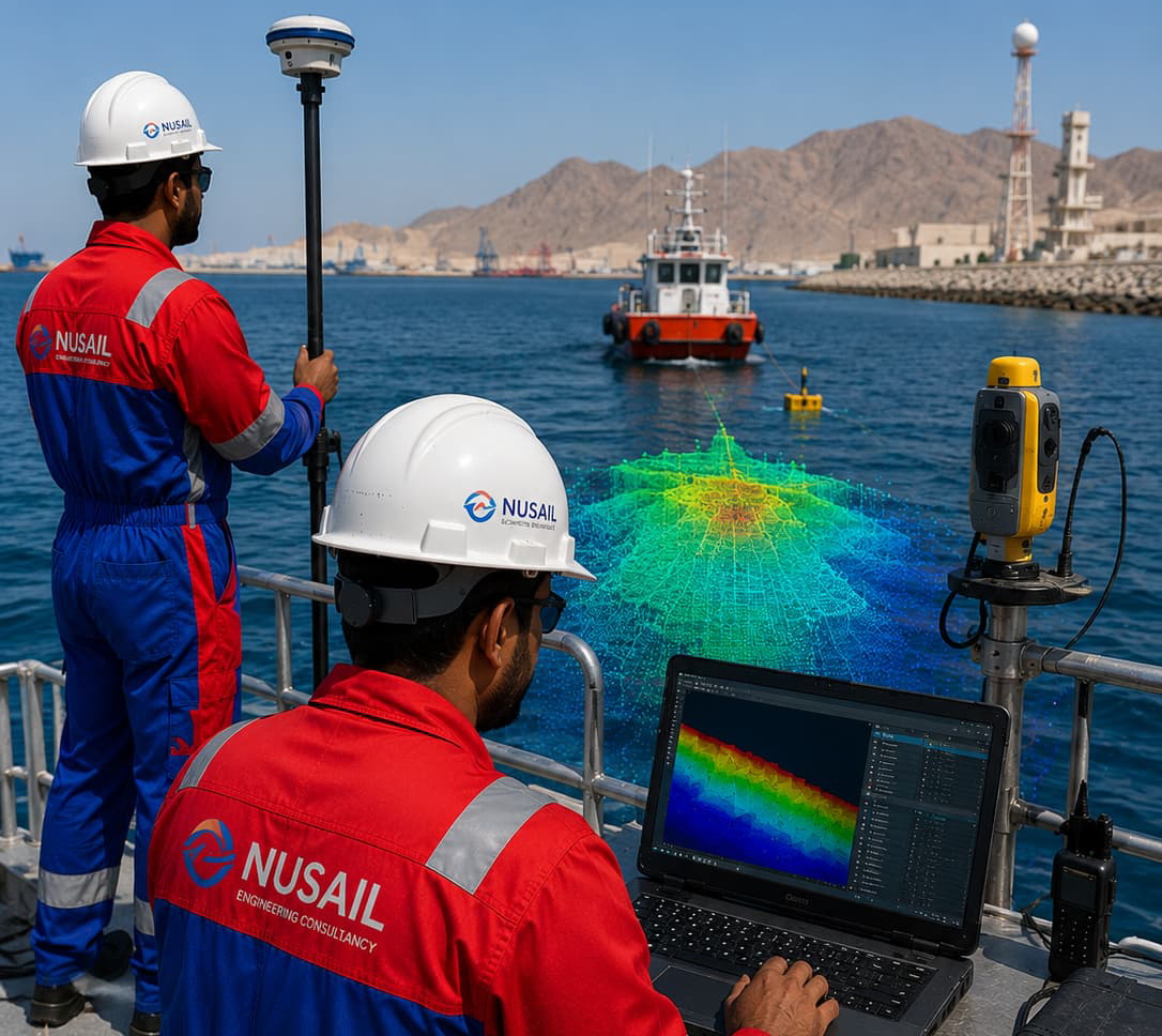
Marine Survey services provide accurate hydrographic and bathymetric data collection for ports, harbors, coastal zones, and offshore developments. Using advanced technologies such as Multibeam Echo Sounders (MBES), Single Beam Echo Sounders (SBES), GNSS positioning systems, and integrated marine survey equipment, we deliver precise seabed mapping, underwater profiling, and terrain modeling to support engineering and marine infrastructure projects.
Our experienced survey teams coordinate closely with vessel operators, offshore crews, and project stakeholders to ensure safe and efficient execution of marine survey campaigns. The collected data undergoes rigorous processing, quality control, and geospatial analysis to produce reliable outputs including bathymetric charts, seabed contours, digital terrain models, and 3D seabed representations for informed decision-making.
Marine survey deliverables support a wide range of applications including port expansion, quay wall assessment, dredging operations, coastal monitoring, navigation channel studies, land reclamation projects, environmental investigations, and offshore infrastructure development. By providing accurate and dependable marine datasets, we help engineers, planners, and asset owners optimize design, construction, maintenance, and long-term operational planning.
Integrated delivery
Marine assignments often require coordination of vessels, tides, safety management and data processing deadlines. We structure reporting so bathymetry, metadata and limitations are transparent for designers and reviewers.
Typical drivers
- Port expansion and maintenance dredging
- Coastal protection and marine structures
- Baseline surveys for environmental monitoring
- Land–marine model integration
Experience context
Selected marine survey projects Oman in our portfolio include port bathymetric commissions—illustrative of the marine environment work we undertake. Full references are available when tender requirements allow.
Related services
Portfolio / Selected case studies
Selected project experience demonstrating Nusail’s capability in land, marine, drone and geospatial survey projects. Full project references can be provided upon request.
Use Bathymetric or Marine filters for port and seabed-related examples among completed survey projects Oman.
Contact / request quotation
Outline marine limits, vessels, HSE expectations and deliverable standards for our team to respond.
Oman office
Building No. 9459A, Way No. 897, Mawaleh North, P.O. Box 143, Postal Code 311, Sultanate of Oman